

3 Solution in 1 Platform
LOKASI Intelligence integrates GIS Software, Big data spatial, anda Spatial analysis.
This combination gives LOKASI the capabilities to VIsualize, Analyze and Optimize the business into one-stop integrated platform.

Reduce Cost
Provides a deep understanding of a business location’s characteristics, LOKASI Intelligence help businesses reduce the cost of surveys and data collection for finding a new business.

Manage Risk
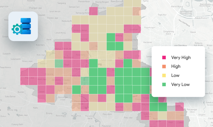
Business risk can be calculated and minimized by using geospatial data such as disasters or the socioeconomic of a location.

Time-saving
Using Software as a Service model, LOKASI Intelligence can be used without requiring any implementation and offer complete data as well as location-based leading to saving time in collecting data and speeding up the decision-making process.

Data-driven
Equipped with geospatial data, LOKASI Intelligence helps business leaders in making informed decisions.
I am text block. Click edit button to change this text. Lorem ipsum dolor sit amet, consectetur adipiscing elit. Ut elit tellus, luctus nec ullamcorper mattis, pulvinar dapibus leo.
A specific place or destination of potential interest such as a supermarket, tourist attraction, government office, and more.

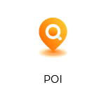
A network of interconnecting roads that accommodates pedestrians, traffic, and vehicles.

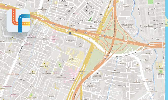
A collection of information on national disaster occurrence.
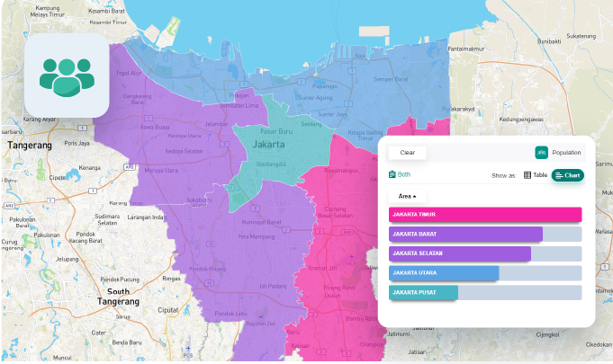
An overview of the population of a given area, including the age, gender, ethnicity, and religion of the people.
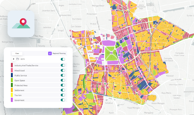
A set of information on urban and city planning.
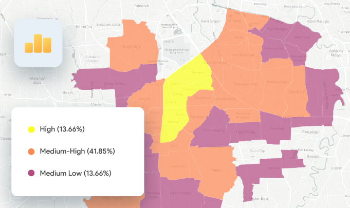
Information about the socioeconomic status in a specific area.
LOKASI provide this data in the whole of Indonesia to help business people get insight into their business location.
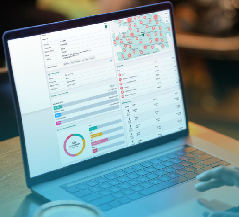
Visualize Any of Your Data in Maps and Analyze it to Create Data-Driven Business Decisions.
Data Visualization
Business Optimization
Geospatial Analysis
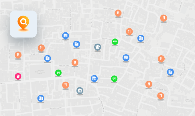
POI
Browse all POIs and visualize their distribution down to the village level.
Thematic Map
Certain Data with specific objects or functions obtained from public data providers, NGOs, and governments.
The data is visualized based on a certain category at a specific boundary administration level.
Grid Analysis
A powerful feature that enables users to analyze an area using certain spatial variables to find the most acceptable and recommended location for expansion.
Site Profiling
A feature used to identify the characteristic of a specific area(s) using a spatial and non-spatial parameter to help improve the business strategy and define the potential market location.
Whitespace Analysis
The process of overlaying client and BVT data to discover potential market gaps and areas that have not yet been covered and visualize the result into a map.

Learn How LOKASI Intelligence Help your Business
[grwebform url=”https://app.getresponse.com/view_webform_v2.js?u=yrFHa&webforms_id=49097902″ css=”on” center=”off” center_margin=”200″/]
Related Content