LOKASI Intelligence
Enable faster, more informed expansion decisions with data-backed geospatial insights that help you evaluate, compare, and prioritize potential areas more efficiently
Trusted by noteworthy clients.


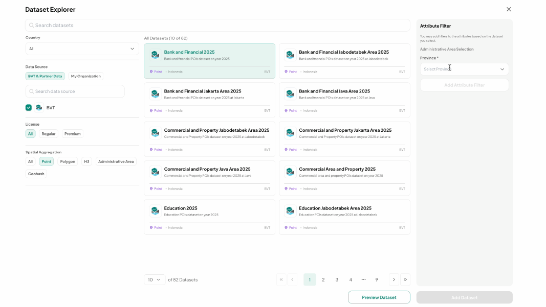
Browse Our Extensive Data Collection
Explore hundreds of location datasets, from demographics and socioeconomic profiles to people traffic and land value. These datasets help you gain deeper market and customer insights, understand demand patterns, and make more confident location and business decisions.
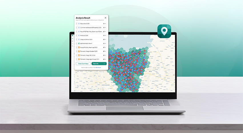
Integrate Your Data Seamlessly
Combine all your datasets and enrich them with location data on a single interactive map. Easily see how different factors connect across locations, uncover hidden patterns, and quickly identify market opportunities without manual analysis.
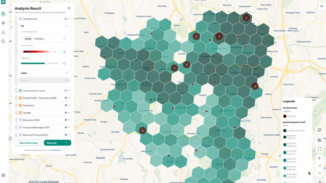
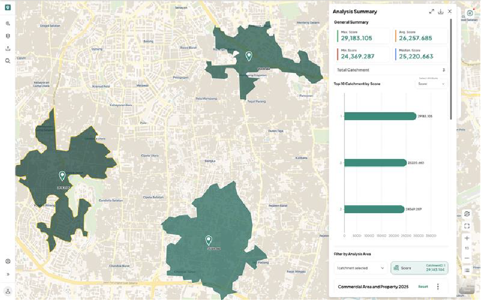
Get High-Potential Location Recommendations
Find strategic locations with strong market potential that match your target audience’s behavior and demographics. Using location data, Grid Analysis feature helps you spot the best areas for growth quickly and easily.
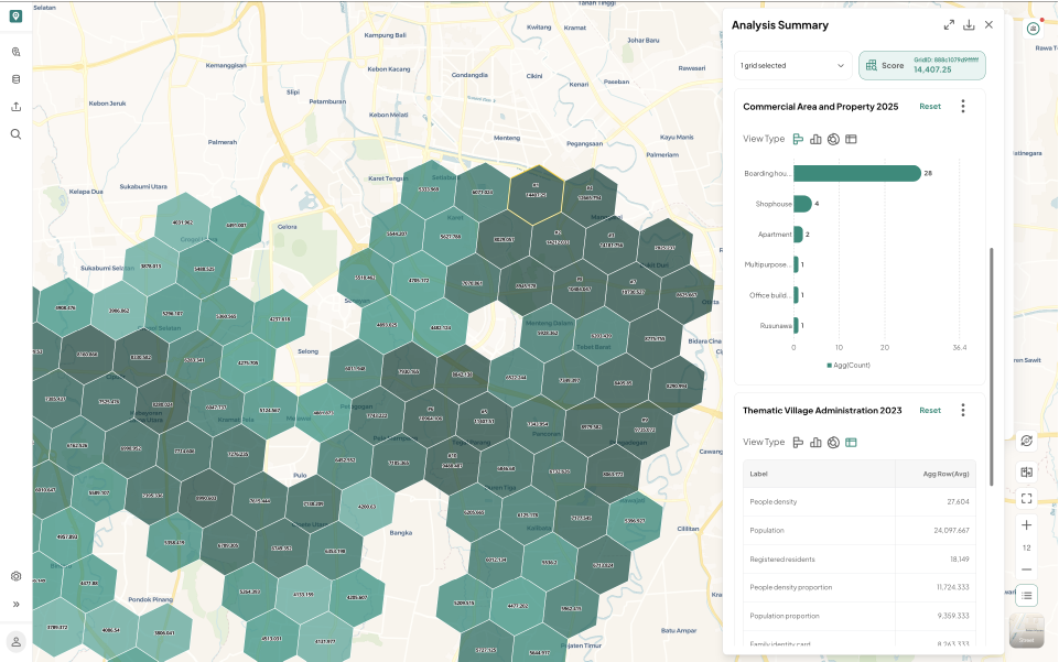
Gain Insights into Your Area’s Key Characteristics
Analyze your selected location using site profiling analysis. Get clear insights into demographics, people distribution, traffic patterns, and accessibility around the site. This helps you understand who your customers are, how they move, and how easily they can reach and see your location.
Some Food for Thought


10 Jul 2026
Site Selection Mistakes That Cost Retail Brands

Get in Touch
With Us Now
Talk to our experts to see how our solutions
support your business goals.