Why location decisions often go wrong
Opening the wrong outlet in the wrong area is one of the most expensive mistakes a business can make. And it happens more often than most teams would admit. The problem usually isn’t a lack of data. It’s the wrong kind of data. Most location decisions still rely on foot traffic counts, competitor proximity, and gut feel. A busy street looks promising. A high-density area seems like a safe bet. But busy doesn’t mean the right audience is there, and high-density doesn’t mean high purchasing power. Here’s what that looks like in practice:- A coffee shop opens on a street corner buzzing with foot traffic all day. Three months later, revenue is barely covering rent. The crowd outside, it turns out, is mostly commuters rushing past on their way to the train station, not people looking to sit down for a drink.
- A marketing team rolls out a city-wide campaign with a sizeable budget behind it. Engagement numbers come back flat. Half the spend went toward districts with an older, lower-income population that has little overlap with the product’s actual buyers.
- Two branches of the same fashion brand sit just 2km apart. One consistently hits its monthly target. The other struggles to break even. Both opened with similar floor plans and similar promotions, yet nobody on the team can point to what’s actually different between the two.
- An FMCG distributor pushes into a new city based on population count alone, the kind of number that looks promising on a slide. Sell-through stays sluggish for months. The area, it turns out, is already crowded with three competing brands occupying nearly every relevant retail shelf, something a population figure alone was never going to reveal.
- A property developer signs a tenant for a new commercial unit without much more than a gut check on the surrounding neighborhood. A year in, the space sits half-occupied. The tenant’s offering, aimed at young professionals, doesn’t match a catchment area that’s dominated by families and older residents.
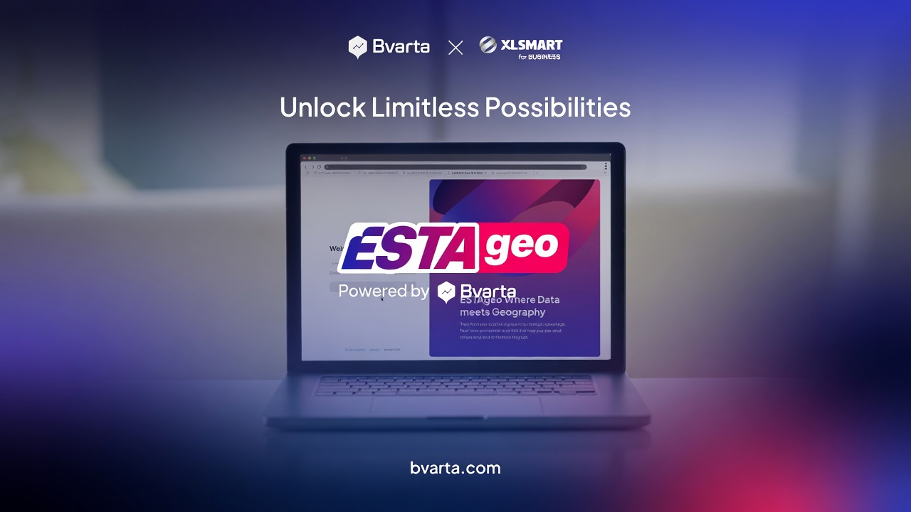
What ESTAgeo is and how it works
ESTAgeo is a spatial intelligence platform built through a collaboration between Bvarta and XLSMART for BUSINESS. It combines Bvarta’s geospatial expertise with XLSMART’s telco analytics to give businesses a clearer, more complete picture of any location they’re evaluating. The platform is designed for business teams, not just data analysts. You don’t need to know GIS or write a single query. ESTAgeo surfaces the answers directly. Under the hood, it runs on three layers: Big Data (including telco data), GIS software, and AI/Machine Learning. Together, these let the platform do something most tools can’t: visualize, analyze, and optimize business decisions from a single interface. ESTAgeo covers six core areas of work:- Site Selection — identify and rank locations based on real population and behavior data
- Market Analysis — map competitor positions, estimate market size, and profile customer segments
- Expansion Analysis — project revenue potential, find market gaps, and model demand
- Sales Performance Management — set territory targets and track performance against location data
- Asset Optimization — match properties and assets to actual surrounding demand
- Data Enrichment — connect your internal data with Bvarta and XLSMART’s external datasets
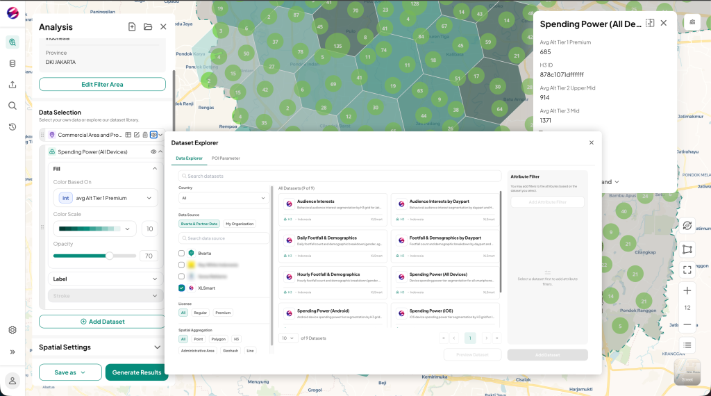 Figure 1: ESTAgeo Mapview & Data Explorer
Each module works independently or together. A retail team might start with Site Selection and Market Analysis. A property developer might go straight to Asset Optimization. The entry point depends on the business question you’re trying to answer.
Figure 1: ESTAgeo Mapview & Data Explorer
Each module works independently or together. A retail team might start with Site Selection and Market Analysis. A property developer might go straight to Asset Optimization. The entry point depends on the business question you’re trying to answer.
The data layer that sets ESTAgeo apart
Most location tools work with the same inputs: census data, points of interest, administrative boundaries. Useful as a starting point. Not enough to make a confident decision. ESTAgeo pulls from two distinct data sources that, combined, tell a much richer story. The first is Bvarta’s geospatial dataset, built over years of data collection across Indonesia. It covers demographics, mobility patterns, socioeconomic status, road networks, land values, points of interest, and property data. This forms the geographic foundation of every analysis. The second is XLSMART’s telco analytics. This is where ESTAgeo separates itself from conventional platforms. Telco analytics surfaces behavioral signals that no map can show. It tells you how many people are actually present in an area at any given time, not estimated from a census but observed from network activity. It breaks down the population by age, gender, and the type of device they use. That last point matters more than it sounds. Whether someone carries a flagship smartphone or an entry-level handset, device tier is one of the most reliable proxies for purchasing power available at scale. Beyond that, ESTAgeo identifies user interest profiles. Is an area dominated by e-shoppers, travelers, health junkies, or gamers? These categories aren’t survey responses. They’re derived from actual usage patterns across XLSMART’s network. This data also breaks down by time window, separating weekday from weekend, working hours from after-hours. An area might be packed with e-shoppers during weekday working hours, then shift entirely to a different crowd come weekend afternoon. That level of granularity opens up analysis that static demographic data simply can’t support, such as timing a promotion to when the right audience is actually present. All of this is aggregated and anonymized. XLSMART processes its network data in full compliance with Indonesia’s personal data protection regulations, meaning no individual-level information is ever exposed. What ESTAgeo gives you is population-level intelligence: accurate, actionable, and privacy-safe. Put both layers together and you get a profile of who is actually there: their behavior, their spending capacity, and what they care about. That’s the context most location decisions are missing.What you get with ESTAgeo
Better data only matters if it leads to better outcomes. Here’s how that plays out across the industries ESTAgeo is built for. Retail and F&B Site selection is where wrong calls cost the most. Retail and F&B teams use ESTAgeo to compare candidate locations side by side, weighing real visitor profiles, purchasing power signals, and competitive density before committing. The same data helps flag when two outlets are too close together, cannibalizing each other’s foot traffic instead of growing the brand’s reach. FMCG Distribution decisions in FMCG often come down to a simple question: where are people actually buying, and where is the market still open? ESTAgeo overlays competitor outlet locations with real footfall data to surface white-space areas, regions with enough addressable population but limited existing competition. That turns expansion planning into something closer to a measured bet than a guess. Real estate and property A property’s value depends heavily on who lives and works around it. ESTAgeo helps developers and asset managers evaluate land potential using SES, age profiles, and consumer mobility, then match that against the most profitable use for the space, whether that means adjusting the tenant mix, repositioning a commercial unit, or validating a site before acquisition. Marketing Campaign budgets go further when they’re pointed at the right zones. Marketing teams use ESTAgeo to map areas by actual age, gender, and interest profiles pulled from telco signals, not assumptions about a neighborhood’s reputation. The same data supports campaign timing, since interest profiles in an area can shift meaningfully between weekday working hours and weekend afternoons. Across all four, the shift is the same: from decisions made on incomplete information to decisions made with a full picture of the people, behaviors, and dynamics in any given area. Ready to see ESTAgeo in action? ESTAgeo is available as an annual subscription, with nationwide coverage, unlimited analysis, and dedicated support included. Bvarta and XLSMART for BUSINESS also offer in-person training sessions for teams getting started. If you’re evaluating locations, planning an expansion, or trying to understand why performance varies across your network, ESTAgeo is worth exploring.FAQ
What is ESTAgeo? ESTAgeo is a spatial intelligence platform developed through a collaboration between Bvarta and XLSMART for BUSINESS. It helps companies make location-based business decisions using a combination of geospatial data and telco analytics. How is ESTAgeo different from other location intelligence tools? Most platforms rely on standard geospatial data like census figures and points of interest. ESTAgeo adds XLSMART’s telco analytics layer, which provides real-time population presence, device tier data, and user interest profiles. This gives businesses a behavioral picture of who is actually in an area, not just an estimate of how many people live nearby. Does ESTAgeo expose personal data? No. All data processed through XLSMART’s network is aggregated and anonymized. ESTAgeo delivers population-level insights, not individual profiles. XLSMART handles its network data in full compliance with Indonesia’s personal data protection regulations. Which industries is ESTAgeo built for? ESTAgeo is used across retail, F&B, FMCG, real estate, financial services, logistics, and marketing. Any business that makes decisions based on geography can benefit from it. What kind of analysis can I run with ESTAgeo? The platform covers six core modules: Site Selection, Market Analysis, Expansion Analysis, Sales Performance Management, Asset Optimization, and Data Enrichment. Teams can use one module or combine several depending on the business question they’re working through. How do I get started? You can reach the Bvarta team directly through bvarta.com to request a demo or discuss your specific use case. ESTAgeo is available as an annual subscription with full platform access, training, and a dedicated helpdesk.