
Contents
- 1 Why Vietnam Has Charging Deserts
- 2 The 2030 Roadmap: What the Transition Asks of the Market
- 3 Four Kinds of Charging Deserts
- 4 A Step-by-Step Framework for Mapping and Closing Charging Deserts
- 5 Location Strategy: Five Factors That Separate an Opportunity from a Dead Zone
- 6 How Geospatial Intelligence Eliminates Charging Deserts
- 7 Common Mistakes to Avoid
- 8 Frequently Asked Questions
- 9 Ready to Find the White Space Before Anyone Else Does?
- 10 References
Why Vietnam Has Charging Deserts
The infrastructure is growing quickly, but it is not growing evenly.- Chargers sit where buildings sit. A November 2024 World Bank report found that Vietnam’s roughly 150,000 charging ports were mainly in apartment complexes, shopping centers, parking lots, and gas stations, while charging along highways remained limited [2]. A UNDP transport expert later cited about 300,000 battery-electric cars, 45,000 charging pillars, and 70,000 charging ports nationwide at the end of 2025 [3]. Port counts differ by source and method.
- Cities absorb most of the supply. Ho Chi Minh City operates 1,052 charging stations (2,127 charging pillars), yet it has around 18 EVs per charging pillar against a recommended benchmark of one per ten, and about 74.76% of the pillars are in urban areas while rural regions continue to face shortages [3].
- Highways, rest stops, and smaller provinces lag. Reporting points to few stations along highways, rest stops, and in smaller provinces, and experts describe a “chicken-and-egg” problem: investment in stations depends on demand, but buyers hesitate when they do not see stations [1].
- The gap has already cost the market. As of April 2025, several Chinese EV brands had reportedly pulled out of Vietnam, citing the lack of charging stations as a key reason [4].
- The scale of the need is large. The International Energy Agency (IEA) estimates Vietnam needs between 100,000 and 350,000 charging stations over 15 years, roughly one for every ten EVs [1].
- Operators are mobilizing. V-Green plans around VND 10 trillion (about US$380 million) for 99 ultra-fast stations along national and provincial highways in 2026, TMT EGreen targets 2,100 stations by the end of 2026 and 30,000 by 2030, and the VETC platform connected more than 350 stations, roughly half of the country’s multi-brand network, after just over a month of operation [5].
The 2030 Roadmap: What the Transition Asks of the Market
The World Bank’s proposed roadmap for Vietnam’s EV transition estimates that building a nationwide charging network will require approximately US$13.9 billion in investment by 2040 [6]. It proposes a phased approach [6]:- 2024 to 2027: focus on high-income households and install public charging in premium residential areas.
- 2027 to 2030: expand public charging to suburban and rural areas.
- After 2030: increase station density nationwide to prepare for mass EV adoption by 2035.
- Multi-brand access. From 1 July 2027, public charging stations in covered locations must be technically designed to serve compatible vehicles from different makers [7]. The rule covers public areas, parking facilities, rest stops, and outdoor stations, but excludes basements, garages, and indoor parking [7]. A charger will compete for every compatible driver nearby, which raises the value of good locations.
- Missing planning standards. As of 2025, experts noted that Vietnam lacked clear standards on site selection, technology, and safety protocols for charging infrastructure [4]. The new regulation addresses technical standards, but reliability across networks still varies considerably [5].
Four Kinds of Charging Deserts
- The urban–rural gap: When about three-quarters of a major city’s charging pillars sit in urban areas, suburban and rural districts are left behind [3]. These are the areas the World Bank roadmap targets next [6].
- Highway and corridor deserts: Long-distance drivers need fast charging at intervals they can rely on. With highway charging limited as of the World Bank’s 2024 report [2], and operators only now building corridor networks, such as V-Green’s 99 planned ultra-fast stations and Charge+’s 17 fast chargers along a roughly 1,700-kilometer route [5], gaps between nodes can still be long.
- Smaller-province deserts: Reporting notes that stations are concentrated in major cities such as Hanoi and Ho Chi Minh City, with few along highways, rest stops, or in smaller provinces [1]. That makes demand in provincial towns harder to evaluate and easier to ignore.
- Grid and feasibility deserts: Electricity supply is a critical pillar: EV charging will push consumption and peak demand beyond current national power plans [2]. Some areas that look attractive on a demand map may not support fast charging without grid upgrades, so a true opportunity requires both demand and a deliverable site.
A Step-by-Step Framework for Mapping and Closing Charging Deserts
- Step 1: Set the target geography. Choose a city, province, or corridor. Local targets matter: for example, an earlier Da Nang plan set a goal of 300 charging stations for electric cars by 2030 [8]. Confirm whether local targets have since been updated.
- Step 2: Map existing supply. Plot every existing charging point, including brand-specific stations that will become accessible to other makers once multi-brand rules take effect [7].
- Step 3: Measure access by travel time, not distance. Calculate drive-time isochrones, such as 5-minute and 10-minute catchments, around each existing charger. Areas outside every isochrone are candidate deserts. A straight-line radius hides barriers like rivers, toll gates, and congested roads.
- Step 4: Overlay demand. Layer population density, vehicle activity, commuting and tourism flows, commercial centers, and fleet routes on top of your access map. A desert only matters if people are in it, or pass through it.
- Step 5: Rank gaps by opportunity. Score each gap on demand potential, current coverage, competition, and site feasibility. Separate “empty and busy” from “empty and quiet.”
- Step 6: Validate feasibility. Check grid capacity, land availability, parking layout, visibility, and lease terms for the top-ranked sites.
- Step 7: Build, measure, repeat. Track utilization and revenue per charger, and feed the results back into the next round of site selection.
Location Strategy: Five Factors That Separate an Opportunity from a Dead Zone
- Latent demand. How many EVs live, work, or travel here now, and how fast is the number growing? Look for areas where demand is rising faster than supply.
- Travel-time access gap. How far, in minutes, is the nearest charger? A 10-minute drive-time gap around a busy node is a stronger signal than a long straight-line distance.
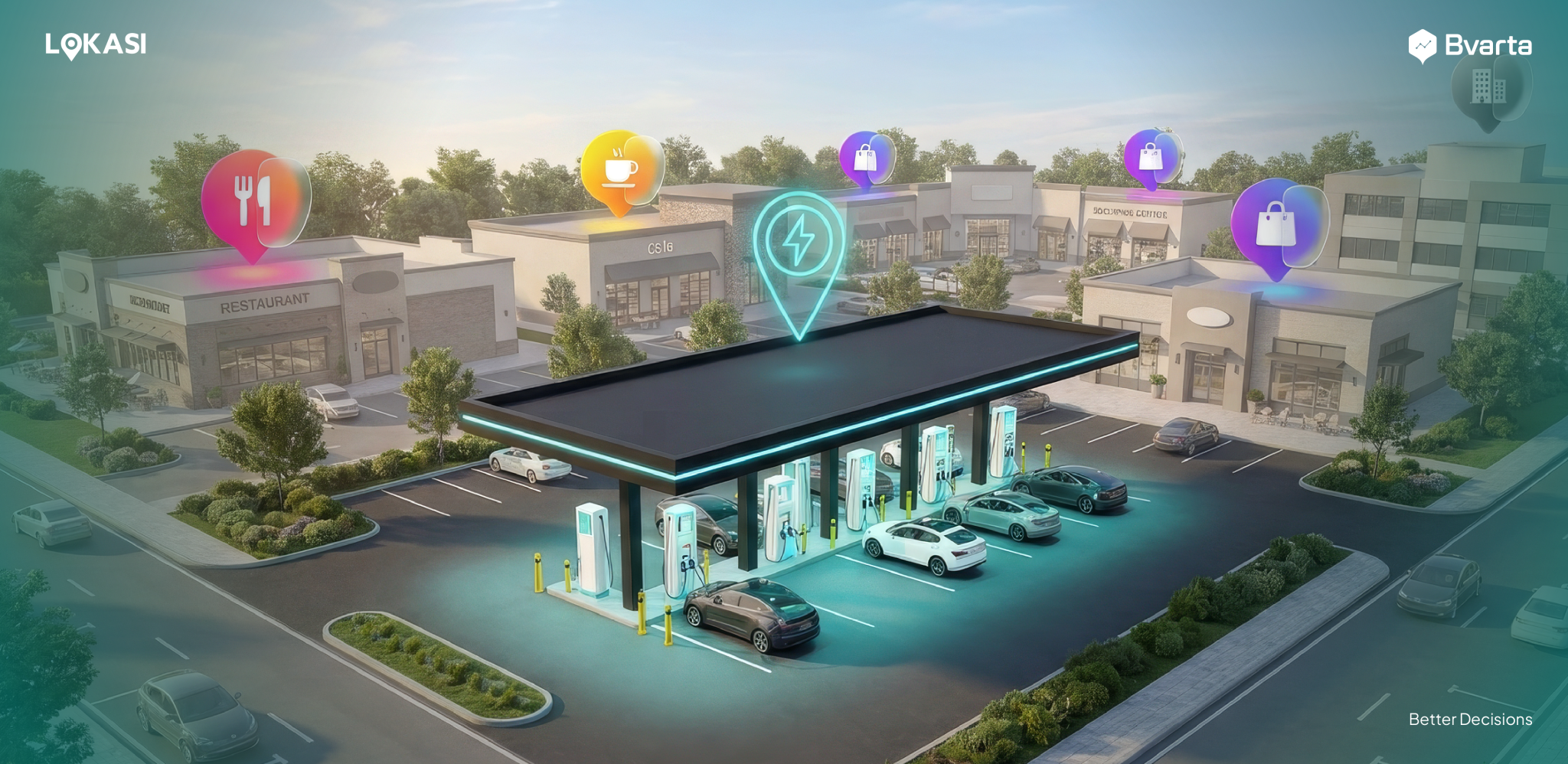
- Dwell time and destination quality. Malls, supermarkets, hotels, tourist sites, and business districts give drivers a reason to stay and charge.
- Corridor spacing. On highways, the question is the interval between chargers. Gaps between existing stations show where the next fast charger should go.
- Site feasibility. Power capacity, land, access, and safety decide whether a promising location can actually be built.
How Geospatial Intelligence Eliminates Charging Deserts
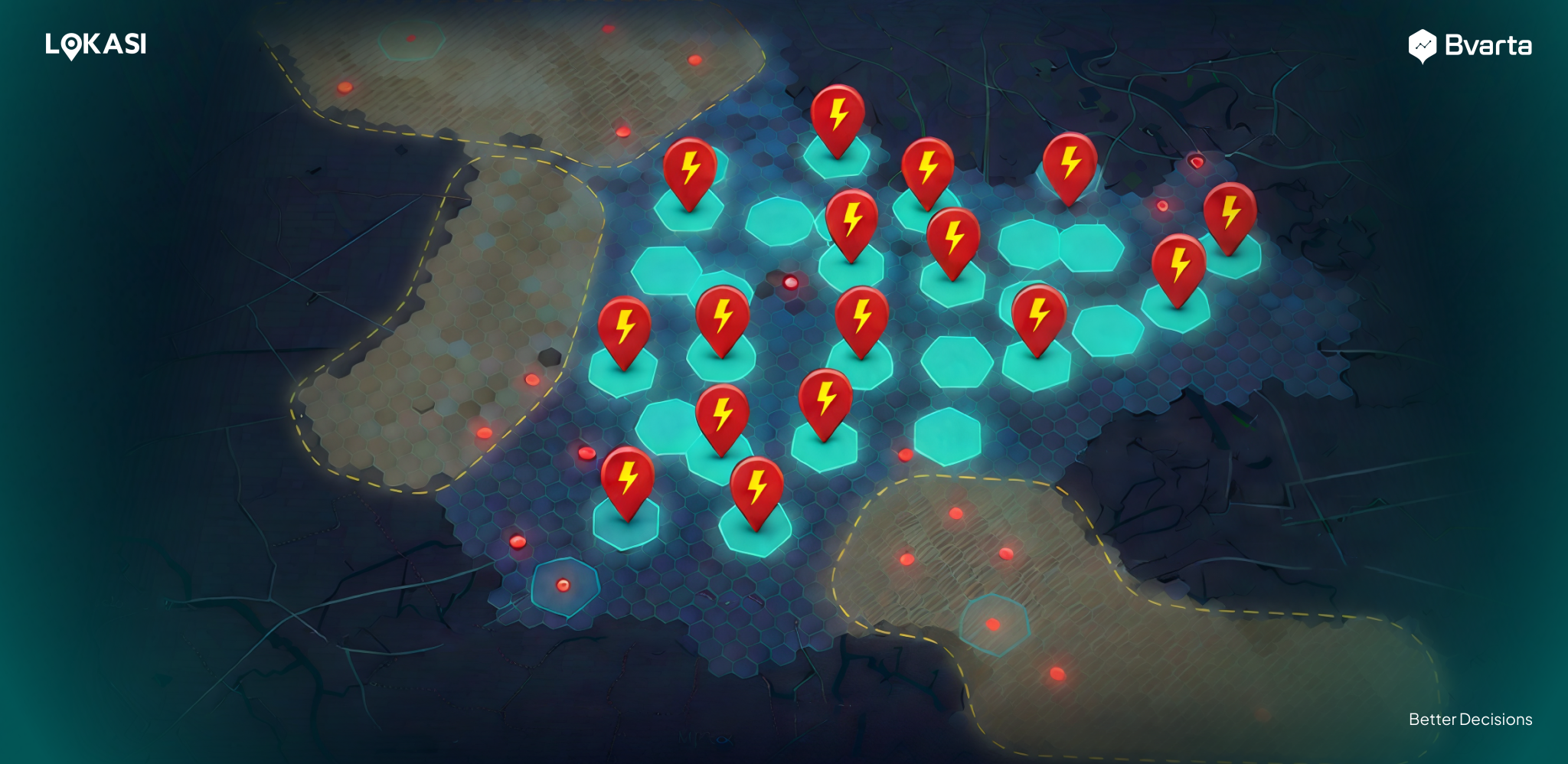
Geospatial intelligence combines map data, population and mobility signals, points of interest, and competitor coverage into one analytical view, so gaps become visible and comparable.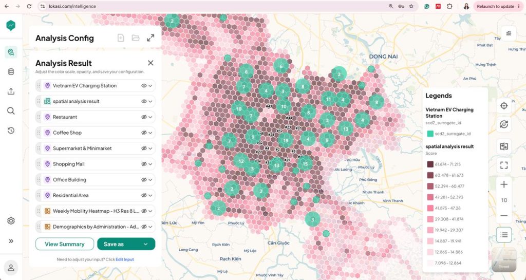 EV Charging Station Opportunity Map using LOKASI Intelligence
- Find the deserts. Visualize existing charging points and analyze 5-minute and 10-minute drive-time catchments around them, so areas with no practical access stand out immediately.
- Separate real demand from empty space. Overlay population, mobility, and area activity to see which gaps carry traffic and which do not.
- Profile each catchment. Understand the malls, offices, residences, transit hubs, and tourist sites inside a catchment to estimate dwell time and visit potential.
- Rank and shortlist sites. Compare candidate locations side by side across a city, province, or corridor, and present the evidence to landowners, partners, and investors.
- Plan corridors. Measure the interval between chargers along a route and identify the nodes where a new fast charger closes the longest gap.
- Scale the analysis. Run the same method across dozens of districts or provinces to decide where to roll out first.
Common Mistakes to Avoid
- Treating every empty area as an opportunity. A desert with no demand is just empty land.
- Measuring distance instead of time. Straight-line radius misrepresents how drivers actually reach a charger.
- Looking only at the biggest cities. The World Bank roadmap points to suburban and rural expansion from 2027 [6].
- Ignoring the grid. A strong demand signal is useless without deliverable power [2].
- Planning for one brand. After 1 July 2027, your catchment includes every compatible vehicle nearby [7].
- Overbuilding early. Start with the capacity your data supports and design the site to expand.
Frequently Asked Questions
- What is a charging desert? A charging desert is an area where drivers cannot reasonably find a public charger within an acceptable travel time. In Vietnam, the sources point to rural districts, highway corridors, and smaller provinces as the most underserved areas [1][2][3].
- Where are Vietnam’s EV chargers concentrated? In late 2024, the World Bank found chargers mainly in apartment complexes, shopping centers, parking lots, and gas stations, with limited coverage along highways [2]. In Ho Chi Minh City, about 74.76% of charging pillars are in urban areas [3].
- How many EV charging stations does Vietnam need? The IEA estimates 100,000 to 350,000 stations over 15 years, roughly one for every ten EVs [1].
- Why does drive time matter more than distance? Because drivers experience a network in minutes, not kilometers. Drive-time catchments reflect the road network, so they show real access and real gaps.
- Can geospatial intelligence guarantee a profitable site? No tool can guarantee demand. It replaces assumptions with measurable signals, lowers the risk of choosing a poor site, and helps you decide where to build first.
Ready to Find the White Space Before Anyone Else Does?
Vietnam’s charging deserts will not stay empty. With the roadmap pushing into suburban, rural, and corridor areas from 2027, and multi-brand access making every good site contestable, the best locations will go to whoever identifies them first. LOKASI Intelligence helps you move first. Map existing coverage, analyze drive-time catchments, overlay demand, and rank the strongest candidate sites across your target provinces and corridors, so you can secure them before another brand does.References
Based on ministry announcements, company disclosures, World Bank reporting, and market reporting as of November 2026.- The Investor, Vietnam boosts charge to match EV growth, 20 April 2025 (citing the International Energy Agency).
- VnExpress International, Vietnam needs $11b to meet increasing EV charging needs: World Bank, 23 November 2024 (reporting a World Bank study).
- Vietnam News, HCM City to develop charging infrastructure for green transport, 22 May 2026.
- Vietnam Economic News (VEN), Vietnam’s EV charging infrastructure key to green transition, April 2025.
- Tuoi Tre News, Vietnam moves to standardize EV charging infrastructure, 29 July 2026.
- VietnamNet, Vietnam eyes $14 billion investment for EV charging network by 2040, 28 November 2024 (reporting the World Bank’s proposed EV roadmap).
- Vietnam News, Charging stations to allow shared use by compatible EVs from 2027, 7 October 2026.
- Vietnam NGO Centre, Vietnam Danang Aims to Develop 300 Electric Car Charging Stations by 2030 .