Just like F&B and retail businesses that rely heavily on location, the property industry faces the same challenge. Location plays a big role in shaping a property’s value, market appeal, and growth potential.
That’s why more and more developers and property professionals are turning to location data and geospatial analytics to spot promising areas, often before the competition does.
In this article, we’ll take a closer look at how geospatial analytics helps property businesses uncover new opportunities, make smarter investment decisions, and stay ahead in a constantly changing market.
Contents
What Is Geospatial Analytics in the Property Industry?
Geospatial analytics in the property industry refers to the process of using geographic and spatial data to assess, analyze, and visualize trends and patterns within the property market.
Through this type of analysis, businesses can better understand how location, surrounding environments, and geographic conditions influence a property’s value and its development potential.
By integrating data such as population density, transportation access, proximity to public facilities, and surrounding economic activity, geospatial analytics provides a holistic view of spatial relationships.
With these insights, developers and investors can make data-driven decisions, from identifying ideal project locations and evaluating regional growth potential to mapping future investment opportunities and risks.
The Benefits of Geospatial Analytics for the Property Business
According to research, more than 60% of property companies have invested in some form of Location Intelligence technology to enhance their decision-making processes. This indicates that the use of location data and geospatial analysis is no longer just a passing trend but has become a crucial necessity in today’s property industry.
Here are several ways geospatial analytics can help property businesses improve their performance and minimize investment risks.
Market Demand Mapping
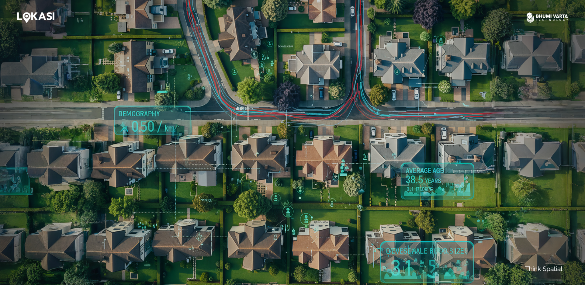
One of the main benefits of geospatial analytics in the property industry is its ability to map investment potential. By integrating various data sources such as demographics, economic conditions, infrastructure, and population activity, geospatial analytics provides a comprehensive view of a region’s characteristics and market potential.
This data is then visualized through interactive maps, enabling businesses to easily identify spatial patterns and market trends that may not be apparent through conventional analysis.
In addition, geospatial analytics supports the creation of different types of thematic maps that enhance the depth of analysis. For instance, heat maps can illustrate fluctuations in property prices and demand across locations, density maps reveal population concentration and area growth, while time-lapse maps display how market conditions evolve over time.
By combining these visualizations, developers and investors can gain a deeper understanding of property market dynamics, uncover emerging opportunities, and design more accurate, data-driven development strategies.
Location Analysis to Identify Strategic Areas
Geospatial analysis plays a key role in providing valuable insights about property locations for developers and real estate professionals.
For instance, when a developer focused on building office spaces is searching for a strategic site for a new project, geospatial analytics can help by offering a comprehensive understanding of the target area’s characteristics.
By integrating data such as demographics, traffic volume, and socioeconomic status, developers can analyze their target areas in greater detail, from assessing growth potential and location visibility to evaluating accessibility for potential tenants or users.
Land Potential Analysis
In many cases, a business may already own vacant land but remain uncertain about what type of property would be most suitable for development. Should it be turned into a residential complex, an apartment building, an office space, or a commercial area?
With the help of geospatial analytics, these questions can be answered objectively using data-driven insights. By combining various datasets such as demographics, population density, regional growth rates, and local income levels, geospatial analysis allows businesses to gain a comprehensive understanding of an area’s characteristics.
From this analysis, developers can identify “buyer hotspots”, or areas with high potential demand for specific types of properties. For example, if the land is located in a neighborhood dominated by young professionals with increasing income levels, developing a modern apartment complex or mixed-use property could be a strategic move.
On the other hand, if the land is situated near a densely populated residential or office area, it may be better suited for commercial or retail development to support surrounding economic activity.
By taking a data-driven approach, developers can minimize risks and maximize investment returns, ensuring every project decision is backed by a clear understanding of market dynamics and site potential.
Property Risk and Security Analysis
Another key benefit of geospatial technology in real estate is its ability to assess environmental risks that can affect the value and long-term sustainability of an investment.
Through this analysis, developers can identify whether an area is prone to natural disasters such as floods, earthquakes, landslides, or wildfires, and better understand the level of risk that may occur in the future.
By using geospatial analytics, environmental data and disaster histories can be clearly visualized on a map. For instance, the system can highlight areas that experience frequent flooding or lie along earthquake fault lines, both of which can influence property values.
These visual insights help developers and investors evaluate whether a location is still suitable for development or if it would be wiser to consider another area with lower risk.
In addition, understanding environmental risks also has a direct impact on operational expenses and property insurance costs. By identifying potential risks early, businesses can anticipate additional costs and design more efficient mitigation strategies.
Make Informed Investment Decisions with LOKASI Intelligence
LOKASI Intelligence is a geospatial analytics platform that integrates location intelligence with comprehensive and accurate location data. With LOKASI, property developers and investors can analyze target areas in greater detail to understand market potential, location visibility, and accessibility.
The platform is equipped with a wide range of valuable datasets, including demographics, people movement, socioeconomic status, land values, and disaster risk information.
By combining these data points, property businesses can map market demand, identify the most strategic investment locations, determine the most suitable property types for development, and assess potential future risks.
With its data-driven approach and interactive map visualizations, LOKASI Intelligence empowers businesses to make smarter, more efficient, and targeted decisions at every stage of property development and expansion.
Learn more about how LOKASI Intelligence can support your business by contacting us at:[email protected] or WhatsApp: 0877-7907-7750
FAQ
What software is used for property management?
One software that can be used for property management is LOKASI. LOKASI is a geospatial analytics platform integrated with location intelligence and comprehensive location data. With LOKASI, property businesses can map market demand levels, find the most strategic investment locations, determine the most suitable property types for development, and even assess future development risks.
What is geospatial data?
Geospatial data refers to data that contains a geographic component, such as demographic data, people traffic data, and other data.
What is geospatial analysis for property?
Geospatial analysis for property is the process of utilizing geographic and spatial data to assess, analyze, and visualize trends and patterns in the property market. Through this analysis, business owners can understand how location, the surrounding environment, and geographic conditions influence the value and development potential of an area.